

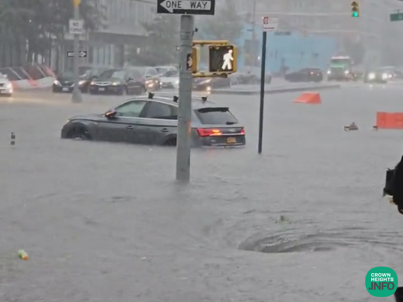
Travel Advisory Issued Ahead of Thunderstorms and Potential Localized Flooding Tuesday and Wednesday
The New York City Emergency Management Department (NYCEM) has issued a travel advisory for Tuesday, July 28. NYCEM is advising New Yorkers to prepare for extended periods of showers and thunderstorms, locally heavy rainfall, and potential localized flooding Tuesday, July 28, into Wednesday, July 29.
The National Weather Service (NWS) has issued a Flood Watch for New York City in effect from 8 a.m. Tuesday to 8 a.m. Wednesday. According to NWS, an anomalous low-pressure system will approach the region Monday night into Tuesday. Chances of rain increase Tuesday morning and stay elevated through Tuesday night, with the greatest chance of thunderstorms and locally heavy downpours between the afternoon and first half of the night. Scattered showers may continue Wednesday, but widespread flooding is not expected after Tuesday night.
“Forecasters have the city at risk for excessive rainfall on Tuesday,” said NYC Emergency Management Commissioner Christina Farrell. “That means there’s potential for street flooding, ponding at underpasses, and water moving into basements. New Yorkers in basement apartments should know their exits now and be ready to move to a higher floor when heavy rain begins. Never walk or drive through floodwater, no matter how shallow it looks. Our teams are working with the National Weather Service and agencies across the city and will keep New Yorkers updated through Notify NYC as the forecast sharpens. For you and your family’s safety, have a plan for the storms in the days ahead.”
The current NWS forecast indicates rainfall of roughly 2 – 5 inches across the city from Tuesday morning through Wednesday morning, with the heaviest rain expected Tuesday afternoon and evening. Localized higher amounts are possible where thunderstorms repeat over the same areas.
Heavier downpours could lead to localized flooding in poor drainage and low-lying areas, along with ‘potential scattered flooding’ on roadways, highways, and underpasses. The NWS Weather Prediction Center has placed the region at a slight risk for excessive rainfall Tuesday, with a marginal to slight risk continuing Wednesday.
The region is also under a marginal risk of severe thunderstorms Tuesday into Wednesday morning. The strongest storms could bring gusty winds, frequent lightning, and brief heavy downpours. Wind gusts of roughly 25 to 30 mph are forecast Tuesday and Wednesday outside of thunderstorms. All storms are inherently dangerous. Any flood advisories or warnings would be issued in real time as conditions develop. Stay informed by checking the forecast at weather.gov/nyc and signing up for emergency alerts at nyc.gov/notifynyc.
Ahead of the front, showers and a few thunderstorms are possible Monday afternoon and evening, mainly north and west of the city. A moderate risk of rip currents continues through Tuesday at ocean beaches. Astronomical tides will rise through the week with a full moon on Wednesday. Showers and a possible afternoon or evening thunderstorm remain in the forecast Thursday.
NYCEM has activated the city’s Flash Flood Emergency Plan, coordinating closely with NWS, city and state agencies, utility providers and private sector partners. This proactive approach includes pre-storm actions, such as targeted inspections and clearing of catch basins in flood-prone areas by agencies like the Department of Environmental Protection and the Department of Transportation, to help reduce street flooding before heavy rain begins. Coordinated interagency calls ensure partners are briefed on emerging risks and prepared to escalate response operations as needed, while specialized emergency assets and response teams remain on standby for rapid deployment. NYCEM’s 24/7 Watch Command continuously monitors weather conditions and tracks developing systems in real time.
New Yorkers should allow extra travel time during periods of thunderstorms and heavy rain. Do not remain in or return to areas or buildings that are flooding, and do not drive through flooded streets. Even shallow water can stall vehicles. Secure loose outdoor items such as patio furniture or trash bins before winds increase. If thunder is heard, move indoors and stay away from open areas. Clear debris from nearby storm drains if it is safe to do so to help reduce street flooding.