MTA Launches New Subway Map With Real Time Data
by CrownHeights.info
The New York City subway map just got way cooler.
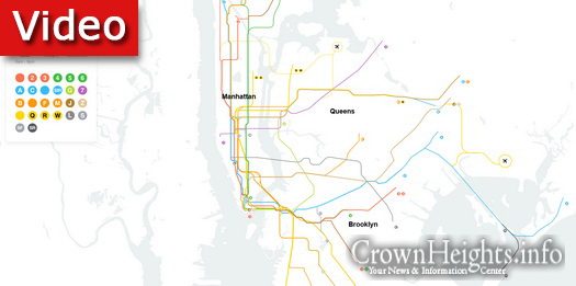
The MTA announced the launch of a beta version of the subway map of the future, all digital with real-time data.
“This week we launched the new MTA Live Subway Map, designed and developed by our friends at @workandco through a partnership with @TransitTechLab,” the MTA tweeted. “It uses real-time data to redraw itself so you can see exactly what’s happening at your station and on your line.”
The map collaborates to bring a clean and modern design with accurate details which allow you to zoom in, and even follow the rains as they move along the tracks.
Listed wait times, accessibility options, and delay information will revolutionalize the city’s commute, and make your life a whole lot easier.
This new map is planned to become the main guide to the city’s subway system, and will eventually replace the present “Weekender” map.
Click Here to view the new map
This week we launched the new MTA Live Subway Map, designed and developed by our friends at @workandco through a partnership with @TransitTechLab.
Check out this short film by @gary_hustwit that goes inside the process of making this gift to New York City. pic.twitter.com/7jm4VETeqF
— MTA. Wear a Mask. Stop the Spread. (@MTA) October 25, 2020