Crown Heights History: The Impact of Farms on Development of Crown Heights Architecture
This series on The History of Crown Heights has been compiled by Instagram account @historyofcrownheights, run by a born and raised Crown Heightser, and shows some of the ongoing research taking place.
The Impact of Farms on Development and Varied Architectural Styles in Crown Heights.
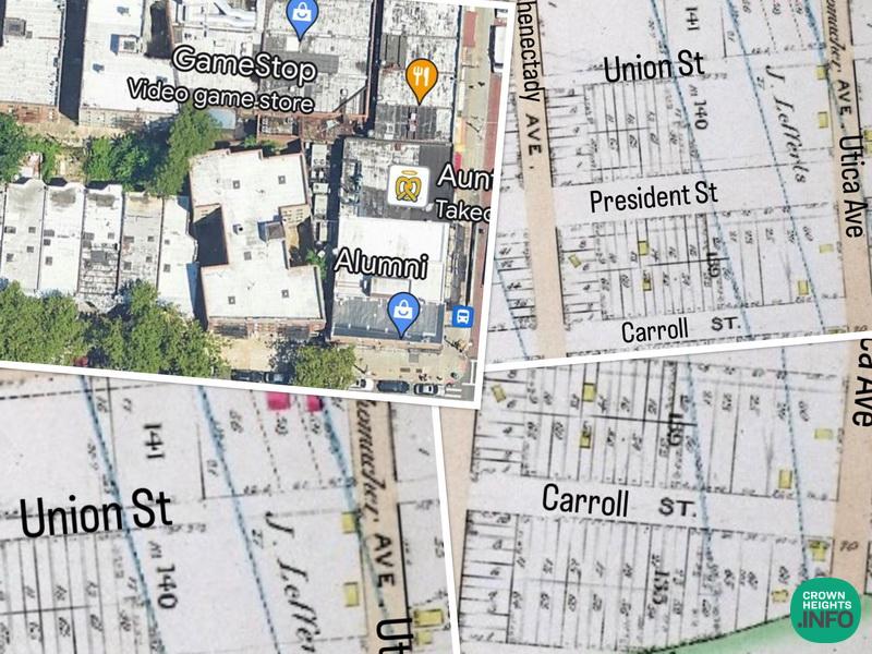
Have you ever wondered why some blocks in Crown Heights have buildings situated in the middle of the block? Pictures one and two clearly depict how the shape of buildings on Utica and Eastern Parkway was influenced by the Lefferts farm. However, there is another intriguing explanation for this phenomenon, as well as the diverse architectural styles found in certain blocks.
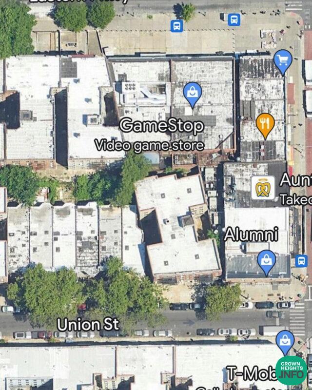
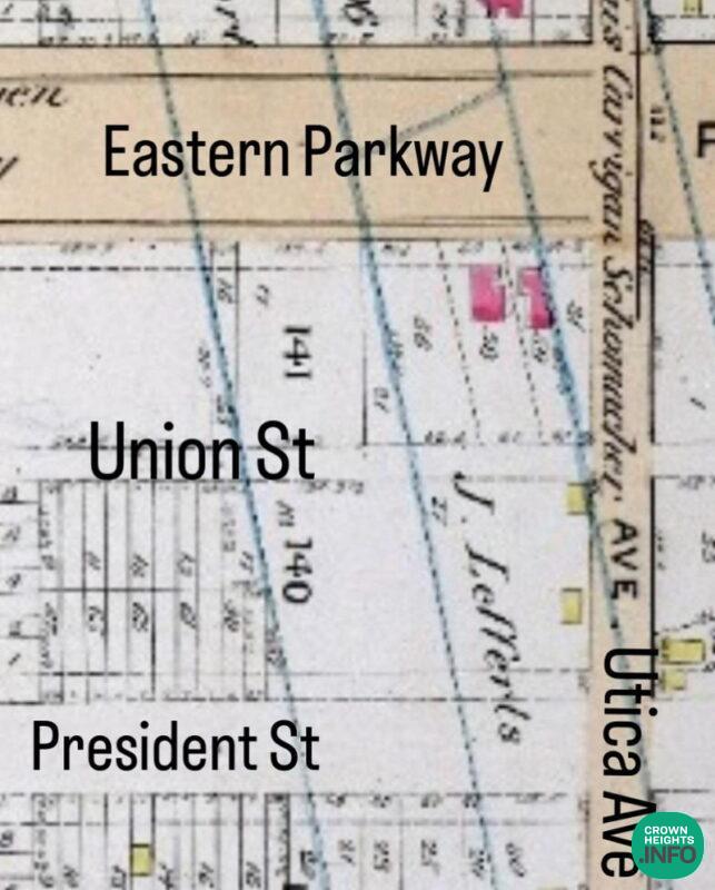
Before Crown Heights underwent extensive development, the area consisted of long strips of land that were not all sold to developers simultaneously. Consequently, buildings were constructed on angles, and some plots of land remained vacant until the subway was built. With the arrival of the subway, the land’s value skyrocketed, making it more economically viable to build apartment buildings or perhaps houses with different styles on those plots.
As time progressed, the development of Montgomery Street occurred after all the farms had been sold off. As a result, most of Montgomery Street features a uniform style of houses from New York Avenues until Troy Avenue. This contrasts with other blocks that experienced more varied architectural designs due to the staggered nature of land sales during the early development phase of Crown Heights.
Pictures 1 and 2 clearly depict how the Lefferts farm’s presence led to the construction of buildings on a slant on Utica and Eastern Parkway.
Pictures 3, 4, & 5 provide an insight into how the topography of the land influenced the layout of the farms and this, in turn, had an effect on the size and shape of the houses built on Carroll Street, between Schenectady and Utica.
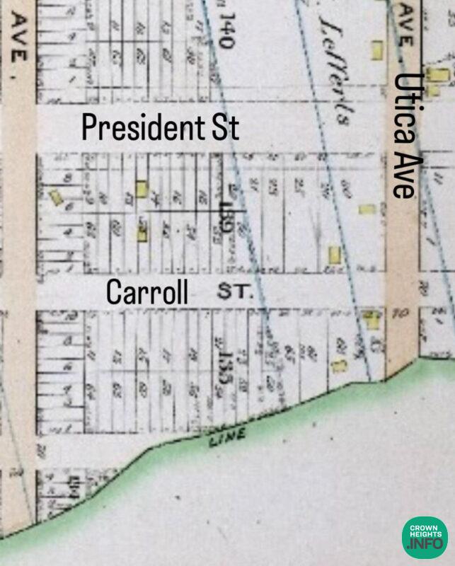
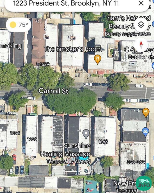
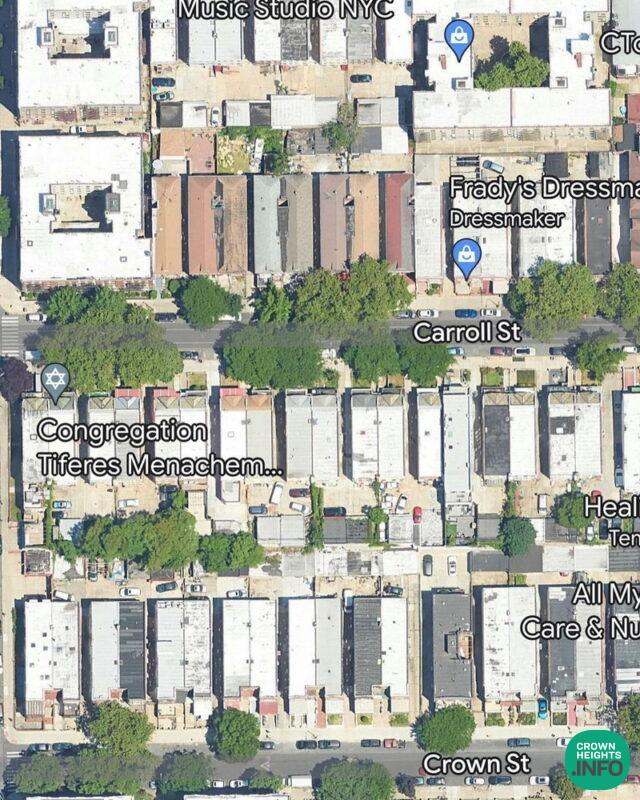
Additionally, Pictures 6 and 7 reveal the extension of farms towards the north, resulting in the presence of buildings in the middle of the block on President Street between Schenectady and Utica as well.
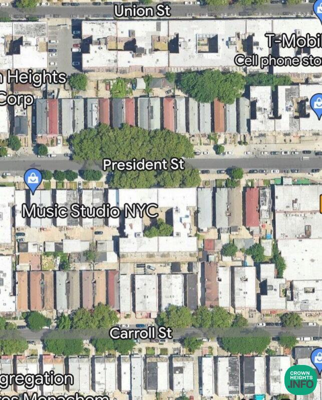
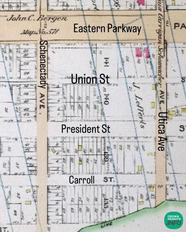
So, if you’re walking down the street and find yourself wondering why the building style suddenly changes, it’s important to know that you may be passing from one farm to another, charted out by settlers in the 1600s (exact confirmation pending based on the land border drawings). This transition in architectural styles could be a reflection of the historical land divisions established centuries ago in Crown Heights.


LS
This series is fascinating!
Thank you for publishing.
I wonder how big the farms were, surely more than the size of one plot on today’s map.
History
They varied but as you can see the block which was 700 feet long had up to 4 farms on it. The farms typically were very narrow and long so they may be 100 to 200 feet wide but they went from eastern Parkway to Empire Boulevard so that would be upto 1800 feet
History
I know I called them farms, but there needs to be another name for these plots of land. They’re also must be an explanation for their peculiar shape.