Crown Heights History: The Borders of Crown Heights
This series on Crown Heights History has been compiled by Instagram account @crownheightshistory, a born and raised Crown Heightser, and shows some of the ongoing research taking place.
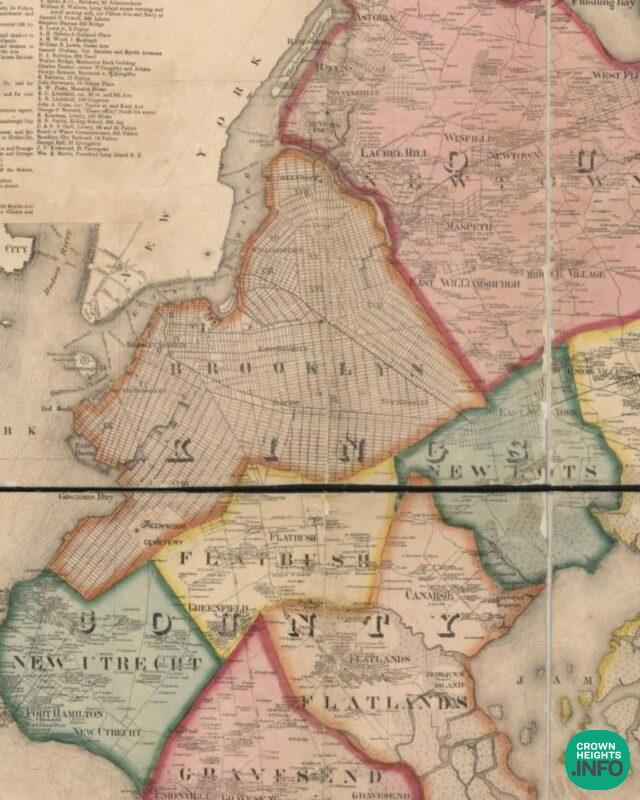
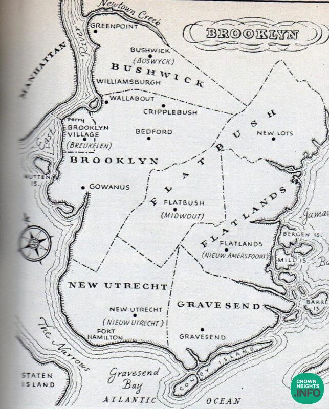
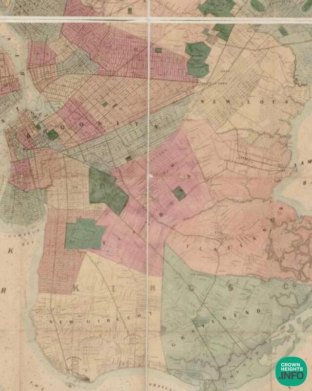
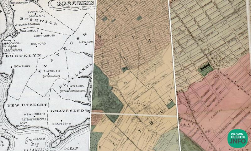
In 1646, the Dutch established six towns with defined borders in present-day Brooklyn. The original six towns were Bushwick, Brooklyn, Flatlands, Gravesend, New Utrecht, and Flatbush. Brooklyn is named after the town of Breukelen in the Netherlands.
These original towns eventually became English settlements and were later consolidated to create the City of Brooklyn. In 1886, the Town of New Lots was annexed, and in 1896, the Towns of Flatbush, Gravesend, and New Utrecht were annexed. Brooklyn was incorporated into greater New York City in 1898.
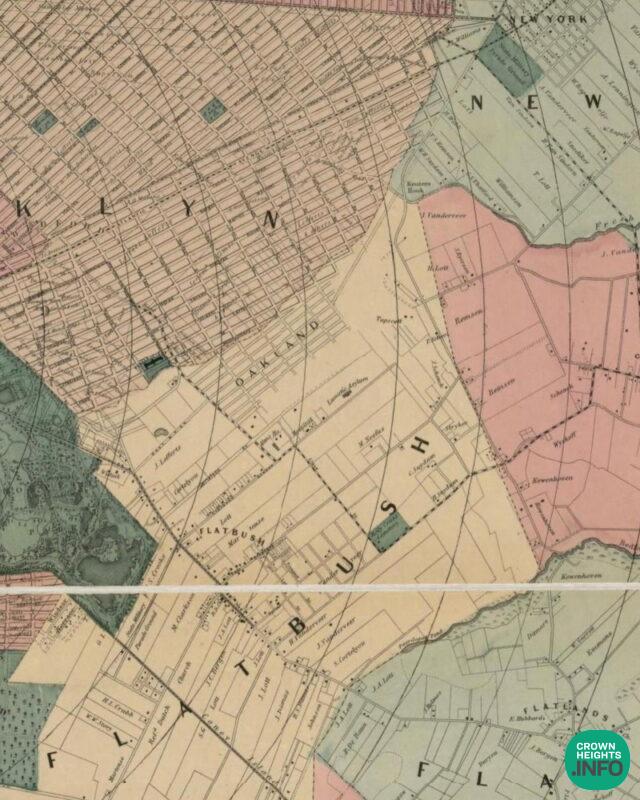
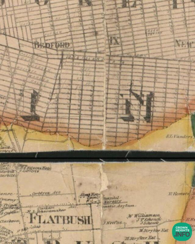
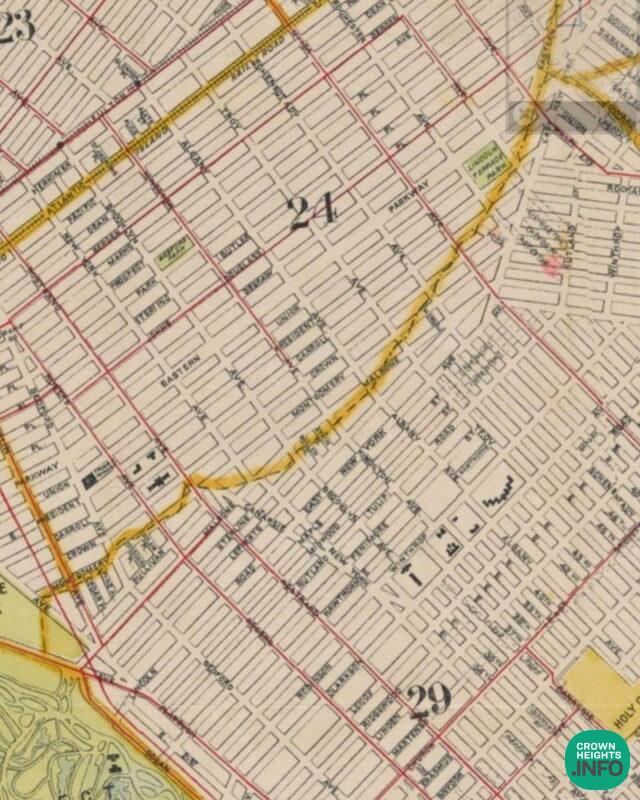
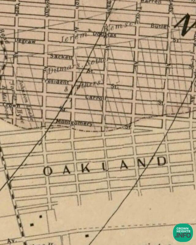
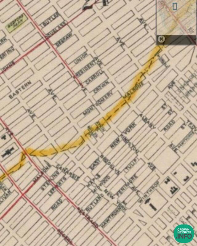
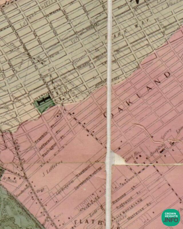
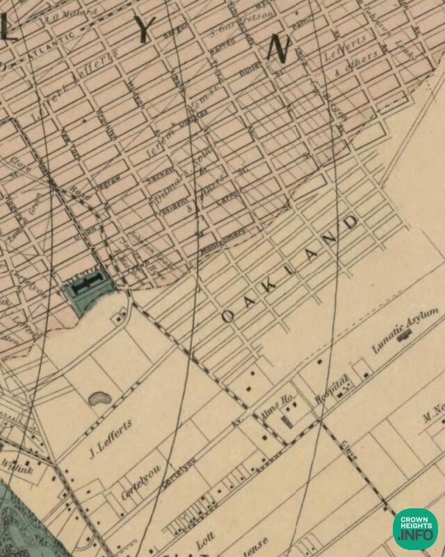
Crown Heights was on the Border of the original Towns of Brooklyn and Flatbush. That’s why there is a line near Montgomery Street on many of the older Brooklyn maps. It is often labeled as the ‘City Line.’ The City Line was visible even on many maps in the early 1900s and was used as the border of the 24th and the 29th Wards and is roughly what today is considered the border of Crown Heights and East Flatbush.
Now everything makes sense.