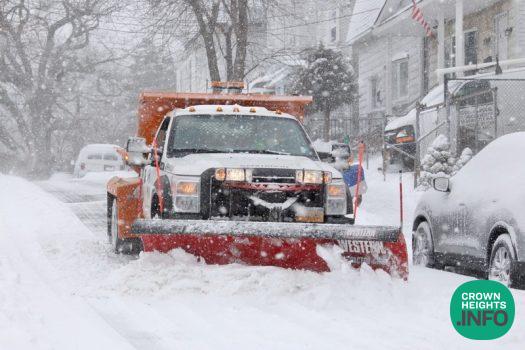
Weather Alert Issued Through Sunday As Snow Storm Moves In
New York City Emergency Management (NYCEM) has issued a Weather Alert for Saturday, December 13 through Sunday, December 14. In coordination with the National Weather Service (NWS), NYCEM is tracking a fast-moving coastal storm expected to bring the season’s first accumulating snow to the city. The system is projected to develop just south of New York late Saturday before moving offshore Sunday afternoon, with temperatures cold enough for all precipitation to fall as snow.
“The winter season is in full swing, including all the winter weather that comes with it,” said New York City Mayor Eric Adams. “All New York City agencies are prepared for this system, and we continue to monitor conditions closely. New Yorkers should all prepare too — avoid driving and give yourself extra travel time with public transit if you do need to travel, stay alert to changing conditions, and sign up for Notify NYC for real-time information updates.”
The NWS has issued a Winter Weather Advisory from 10 p.m. Saturday to 1 p.m. Sunday. According to the latest forecast, snow may begin as early as 10 p.m. Saturday, with steadier snowfall developing around midnight. The majority of accumulation is expected between 4:00 a.m. and 10 a.m. Sunday, with snow tapering off by approximately 2:00 p.m. as the system exits the region. Snowfall totals of 2 to 2.5 inches are expected citywide, with localized amounts up to 3 to 3.5 inches possible, particularly across Staten Island, southern Brooklyn, and southeastern Queens. Snowfall rates are expected to remain light, generally under one-half inch per hour.
While no flooding or severe storm threats are anticipated, slick and snow-covered roads may disrupt the Sunday morning commute, and New Yorkers are urged to exercise caution when traveling and allow extra time to reach their destinations.