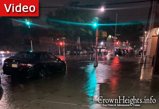
Flooding Hits Low Lying Brooklyn Areas As Henri Approaches
by Crownheights.info
As hurricane Henri approaches the shores of Long Island Motzei Shabbos, torrential rains have caused significant flooding in the low lying areas of Brooklyn.
“At 1132 PM EDT, emergency management reported thunderstorms producing heavy rain across the warned area,” the National weather service warned in a Flash Flood Warning. “Between 2 and 3 inches of rain have fallen. Additional rainfall amounts of 1 to 3 inches are possible in the warned area. Flash flooding is already occurring.”
Video footage from Williamsburg shows waterfalls of water pouring off a street and into a buildings below street level access and cars driving through inches deep street length puddles.
Other areas including entire sections of the belt parkway are also under water, creating a standstill and traffic nightmare even before Henri reaches land.
The hurricane is expected to make landfall on Long Island early Sunday afternoon, with wind near 50 mph and lots of rain. The storm is also expected to bring flash flooding and a storm surge to Brooklyn, putting all low lying areas in danger.
The National Weather Service Flood Watch also remains in effect from 8:00pm tonight through Monday morning.
Firefighters already responded to an incident in Park Slope where multiple people were rescued from a submerged vehicle.
Water flowing in fast into houses on Throop Ave. pic.twitter.com/8qudi0mOdQ
— WILLIAMSBURG NEWS (@WMSBG) August 22, 2021


