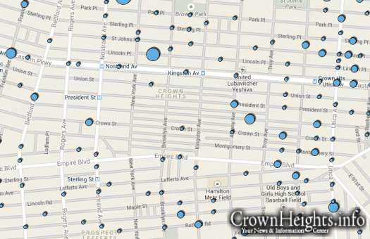
NYPD Releases Interactive Crime Map
The City of New York debuted an interactive crime map that enables the public to search and access basic data on felony crime occurrences by location. It’s accessible through the NYPD website at maps.nyc.gov/crime.
The website provides felony crime information for the prior calendar year, current year and by month within the current year.
The map was built by the Department of Information Technology and Telecommunications (DoITT) using Google products with crime complainant data as reported to the NYPD.
Crime statistics by precinct have been available on the Police Department’s website since 2003 and are updated weekly at NYPD website.
New York City Police Commissioner Raymond W. Kelly said: “With unprecedented population levels, New York City is safer than ever, with homicides on pace this year to fall below recent historic lows. This administration has relied on data to drive its crime fighting, and this map helps enhance New Yorkers’ and researchers’ understanding of where felony and violent crime persists.”
Chief Information and Innovation Officer Rahul N. Merchant said: “DoITT employs innovative technology to improve the accessibility of critical public information. The interactive crime map builds on report data and presents it visually in neighborhoods across the five boroughs, keeping the public informed about what is going on in their community.”


anyone notice
anyone notice how much cleaner the Jewish schunah is.. much less blue dots than other areas!
Maple St resident
To #1
1 blue dot is 1 to many…
K
Blue and white – zionistic?