
Crown Heights History: The Forgotten Neighborhood of Malboneville
This series on Crown Heights History has been compiled by Instagram account @crownheightshistory, a born and raised Crown Heightser, and shows some of the ongoing research taking place.
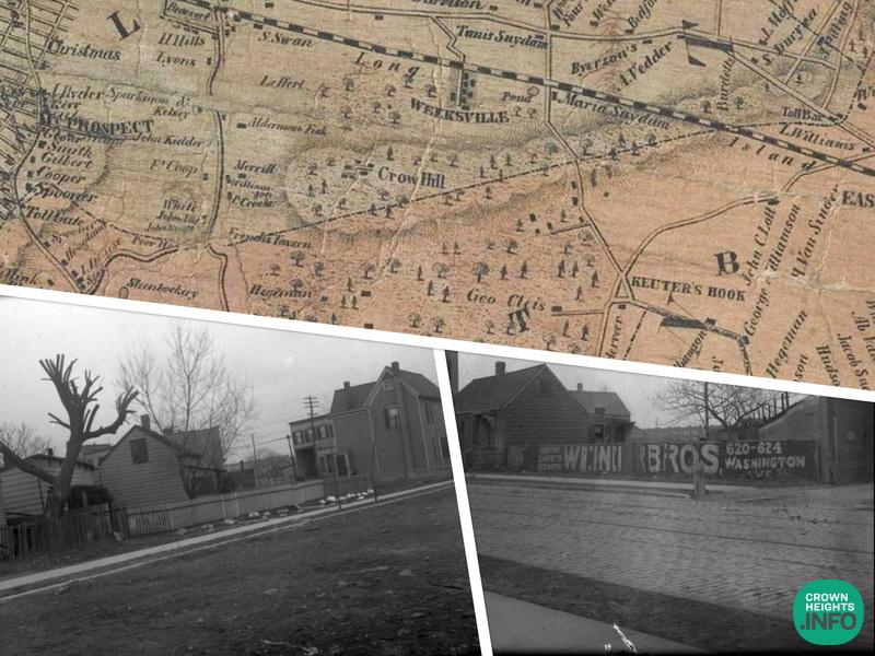
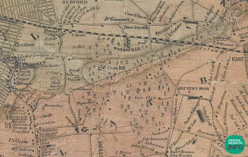
Uncovering Crown Heights before it was developed has lead to many interesting discoveries. We’ve uncovered pictures of the farms on Crow Hill and we’re looking into the individual characters who lived on these farms and scattered shanties that occupied that land pre-Crown Heights era.
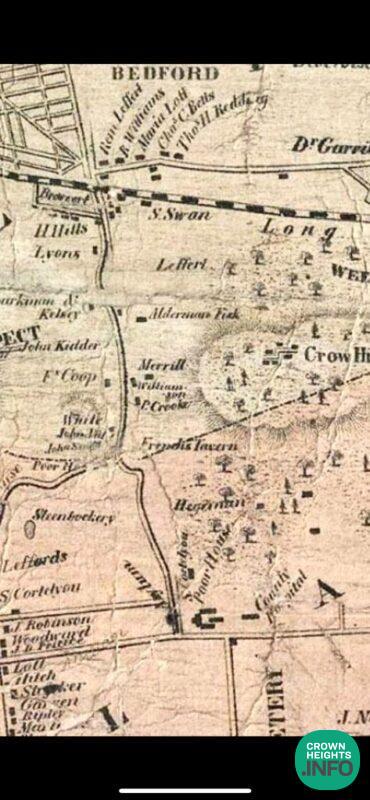
One neighborhood that has been lost to history was that of Malboneville. We all know that Empire Blvd was called Malbone Street and there’s still a tiny street called Malbone Road, but it turns out the area between Brooklyn Ave and Nostrand Ave around Empire Blvd was called Malboneville. There’s of course a debate about of what the exact borders were, but that’s prevalent when the whole area is woods and farms.
In the 1830s almost all Crown Heights was covered with forest trees, Ralph Malbone, a well-known citizen of Brooklyn, started selling off lots close to the city line around Montgomery Street between Nostrand and New York Avenues. This small settlement came to be known as Malboneville.
Crow Hill was east of Malbonville and it ran along the Bedford Hills from New York Avenue till about Schenectady Avenue.
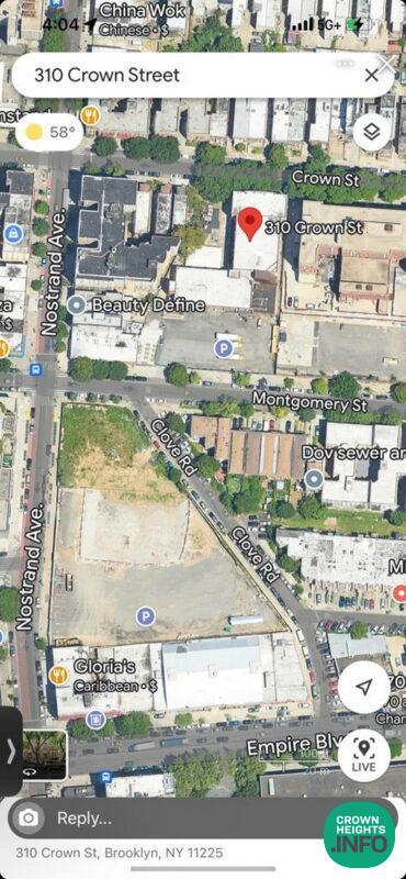
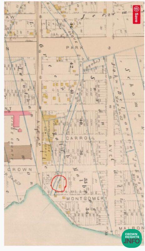
The center of the neighborhood was where Beis Rivkah School is today facing Clove Road which was the main thoroughfare to get from Bedford to Flatbush.
“About the year 1833 Ralph Malbone built a house facing Clove road, between what are now Crown and Montgomery streets, which subsequently became well known to all sporting men, far and near, as French’s.”
“Subsequently the house became a regular roadside tavern and was a great resort for the sporting gentry previous to and during the Civil War. In antebellum times there was a stage line from Fulton Ferry to Bedford and thence, via the old Clove road, to Canarsie, then, as now, a great resort for fishermen. French’s was the stopping place of the stages. It was also the half way house for the farmers from the neighborhood of Canarsie, Flatlands, Flatbush, Sheepshead Bay, Coney Island, etc., and it was no uncommon thing in those days to see 100 farm wagons and other vehicles grouped in the neighborhood of French’s.”
In the 1870s The Boulevard (Eastern Parkway) was cut through and Clove Road stopped being used. French’s closed and his daughter lived there until development reached that area and the house was sold.
You never heard of this until today.


Anonymous
awesome article – loved it
Nochum kurinsky
I believe there was also a terrible trolly accident on clove rd in which 180 or so people died.
History
Yeah that well known why the name switched
History
Empire Boulevard was called Malbone Street until 1928 RL there was a crash on the The S (Brighton Beach line back then) and because of the association with the name of that street they changed it To Empire Blvd. how that resembles a Boulevard I’ll never know, because until recently, there wasn’t any Blvd style buildings etc. Anyway for another post vdal.
Transit Workers' Strike
The crash was due to the railroad using poorly trained “scab” workers during a transit workers’ strike. Thereafter the NYC trains have just shut down when there’s a transit workers’ strike.