Weather Alert Issued For Rain and Thunderstorms On Monday
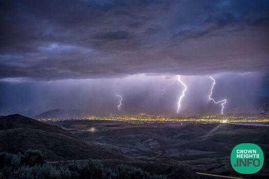
The New York City Emergency Management Department (NYCEM) has issued a Weather Alert for Monday, March 16. The National Weather Service (NWS) forecasts rain and thunderstorms for New York City as a strong cold front moves through the region. The anticipated rain is expected to impact the evening commute. NYCEM has activated the City’s Flash Flood Emergency Plan.
According to the latest forecast, rain is expected to begin Sunday evening around 7 p.m. and continue overnight into early Monday morning. Periods of moderate rain are likely throughout the overnight hours and into the Monday morning commute. Scattered thunderstorms are possible late Monday morning through the afternoon, with the greatest risk for stronger storms during the evening. The most active period is expected between about 6 p.m. Monday and 2 a.m. Tuesday as the cold front moves across the region. During this time, heavier downpours, gusty winds, and organized thunderstorms may develop. Rain will gradually taper early Tuesday morning. A brief rain or snow shower cannot be ruled out on Tuesday morning as cooler air moves into the region.
“New York City is bracing for rain, thunderstorms, and high winds on Monday,” said NYC Emergency Management Commissioner Christina Farrell. “NYC Emergency Management has activated the City’s Flash Flood Emergency Plan and is closely coordinating with the National Weather Service and our partner agencies in response to the expected conditions. We urge New Yorkers to prepare for potential impacts, allow extra travel time, and consider using public transportation. Sign up for Notify NYC by texting NOTIFYNYC to 692-692 to receive the latest weather updates.”
Rainfall totals across New York City are expected from 1.0 to 1.1 inches, with localized amounts up to 1.25 inches where thunderstorms develop. Most rainfall rates will remain under 0.25 inches per hour, though heavier showers could briefly produce rates near 1 inch per hour. There is a Wind Advisory in effect from 2 p.m. Monday to 4 a.m. Tuesday. South to southeast winds are expected to increase through Monday, with sustained winds of 15 to 22 mph and gusts up to 55 mph during the evening as the cold front moves through the area.
The severe weather risk remains low but not zero. There is a slight chance of isolated strong storms capable of producing damaging wind gusts on Monday evening. Localized flooding is possible, especially in low-lying areas, underpasses, and locations with poor drainage. Ponding on roadways may develop during heavier downpours and where storm drains are clogged.
New Yorkers should allow extra travel time during periods of heavy rain, especially during the Monday evening commute. Avoid driving through flooded streets. Even shallow water can stall vehicles. Secure loose outdoor items such as patio furniture or trash bins before winds increase.